


Plan of Norman Exeter
Back to Time Period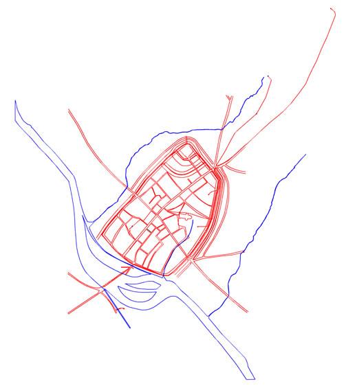
This digitised map, taken from the Exeter Urban Archaeological Database compiled by Exeter Archaeology and funded by English Heritage, plots very precisely the positions of the known features of the Norman city; it should be used in conjunction with the interpretative map.
The estimated position of the river Exe at this period is shown in blue outline. Built features are shown in red. Within the oval enclosure of the city walls the street plan surviving from the Anglo Saxon period was modified by the insertion of the castle at the northern corner of the city. The extent of the Cathedral Close (to the right of the plan) at this period is uncertain as is the layout of approach roads to the city walls.
Acknowledgments: Exeter City Council English Heritage

 at this period is uncertain as is the layout of approach roads to the city walls.)