


German map of Exeter
Back to Time Period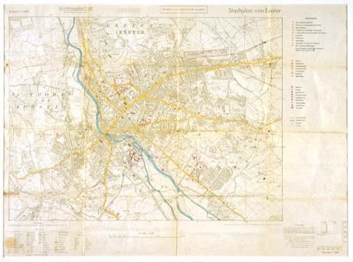
As Germany prepared for war in the late 1930s its forces found British maps, mainly at old Imperial scales, unsatisfactory and therefore prepared a new set of maps of English cities at metric scales.
This German war map of Exeter highlights the city's principal strategic targets such as railway stations, gas works, barracks and hospitals. After the war it somehow found its way to the Exeter city planning department, where it was used in post-war years.
Acknowledgments: RAMM