


Plan of the city c 1220–1540
Back to Time Period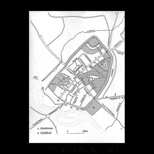
The map shows medieval Exeter as it appeared in the 14th and 15th centuries. The Cathedral Close and precincts of various religious houses occupy large parts of the city, whilst the royal castle of Rougemont continues to dominate the northern area. Some of the medieval street names, such as Rack Street, Coombe Street, Smythen Street, Paul Street and Goldsmith Street, survive within the walls today. Others’ names have changed, such as Corre Street (now Gandy Street), Canon Street (now Cathedral Close) and Strike Street (now Chapel Street).
Source: Kain, R. and Ravenhill, W. (eds) 1999, 'Historical Atlas of South-West England'.

, Canon Street (now Cathedral Close) and Strike Street (now Chapel Street).
Source: Kain, R. and Ravenhill, W. (eds) 1999, 'Historical Atlas of South-West England'.)