


Detail of the Hogenburg Map showing the Cathedral
Back to Time Period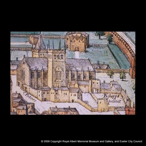
This detail of Hogenburg’s map shows the Cathedral and surrounding buildings in the 1580s. In order to give the cathedral a sense of height above its surroundings, Hogenburg made its elevations taller, but had to reduce the number of bays if he was not to extend the Cathedral far into the Close. By this time the South tower had lost its old Norman spire, but the North tower still retained its spire. The range of buildings shown in front of the Cathedral lay on the south side of the Cloister and was partly dismantled during the Civil War. The old medieval crenellated wall enclosing the west side of the Cloister and joining onto the West front of the Cathedral can be seen to its left.
Acknowledgments: RAM Museum