


Plan of Exeter c 1600
Back to Time Period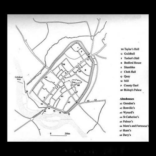
The plan can be used with Hooker and Hogenburg’s view, drawn a few years earlier. It shows the locations of the principal features of the late Elizabethan city. Many (such as its churches, Guildhall and Tuckers Hall) remained from the Middle Ages, but the growth of mills on the leats beside the Exe and the new quayside were notable new developments. The rising number of almshouses reflected efforts by the rich elite to provide homes for at least some of the city’s poorest citizens.
Source: Kain, R. and Ravenhill, W. (eds) 1999, 'Historical Atlas of South-West England'.

 remained from the Middle Ages, but the growth of mills on the leats beside the Exe and the new quayside were notable new developments. The rising number of almshouses reflected efforts by the rich elite to provide homes for at least some of the city’s poorest citizens.
Source: Kain, R. and Ravenhill, W. (eds) 1999, 'Historical Atlas of South-West England'.)