


Plan of the town c 420–880
Back to Time Period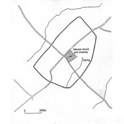
The plan shows all that is known of the lay out of Exeter in the long period between the abandonment of the Roman town after AD 400 and before the re-establishment of town life at the end of the 9th century. The Anglo-Saxon minster with its surrounding cemetery lies at the centre of the walled area and the main streets of the later medieval town- High Street and Fore Street, North Street and South Street- may well have been in place throughout much of this period, although this is not firmly known. The presence of a spring lying to the west of the minster (its site now besides the Bishop’s Palace) may have been a significant factor in the siting of the Minster.
Source: Kain, R. and Ravenhill, W. (eds) 1999, 'Historical Atlas of South-West England'.
Acknowledgments: Exeter City Council

 may have been a significant factor in the siting of the Minster.
Source: Kain, R. and Ravenhill, W. (eds) 1999, 'Historical Atlas of South-West England'.)