


Ogilby’s road map of the Exeter to Dorchester road
Back to Time Period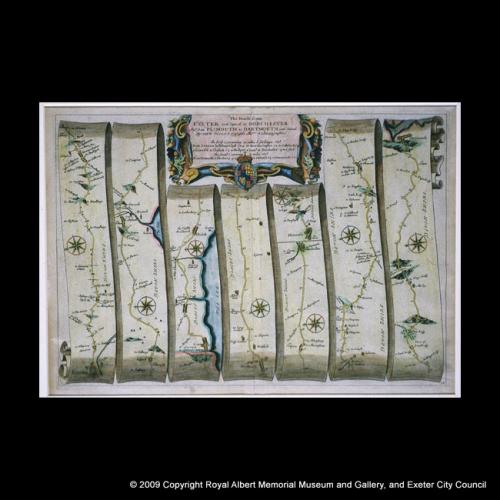
John Ogilby's books of measured road maps of Britain, first published in 1695, were an innovation in their day. The scrolls on the left of this page present the road from Exeter (bottom left) through Heavitree to Clyst St Mary, then on to Lyme Regis ('Lime') and Dorchester. Ogilby measured the mileage of the roads as he travelled, together with hills, rivers and occasional incidental details.
Acknowledgments: RAM Museum

 through Heavitree to Clyst St Mary, then on to Lyme Regis ('Lime') and Dorchester. Ogilby measured the mileage of the roads as he travelled, together with hills, rivers and occasional incidental details.)