


Plan of the Roman town c AD 75–150
Back to Time Period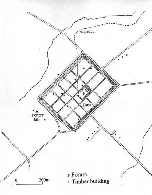
The plan shows the town which was laid out following the departure of the legion. The defensive circuit of the fortress marked the edges of the new town, and most of its street system was simply taken from the earlier layout of the fortress. A new forum was laid out to one side of the central axis of the town and its basilica was constructed on top of the remains of the legionary bathhouse. Beside it, the towns public baths were placed on the sloping ground where South Street now lies. On the surrounding insulae (islands of land) timber buildings grew up, some of which were evidently shops. Outside the fortress defences were further timber buildings, and some of the industries set up to supply the fortress continued into the early civil period.
Source: Kain, R. and Ravenhill, W. (eds) 1999, Historical Atlas of South-West England.
Acknowledgments: Exeter Archaeology

 timber buildings grew up, some of which were evidently shops. Outside the fortress defences were further timber buildings, and some of the industries set up to supply the fortress continued into the early civil period.
Source: Kain, R. and Ravenhill, W. (eds) 1999, Historical Atlas of South-West England.)