


The Ordnance Survey map showing Exeter in 1801
Back to Time Period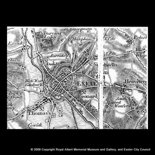
The map was surveyed in 1801 and published in 1809. Although the scale is small, its accuracy is generally very high. The map names many of the outlying settlements, now in the city suburbs, with Turnpike gates (‘To Pike') and the City Workhouse (‘Poor Ho.’). Sloping land is indicated by shading.
Acknowledgments: Westcountry Studies Library

 and the City Workhouse (‘Poor Ho.’). Sloping land is indicated by shading.)